NOAA / NWS
Snapshot unavailable
Live summit weather is temporarily unavailable. Static trip-planning guidance remains available below.
Mount Eisenhower is a 4,780-foot mountain in the Presidential Range of the White Mountains.
Mount Eisenhower
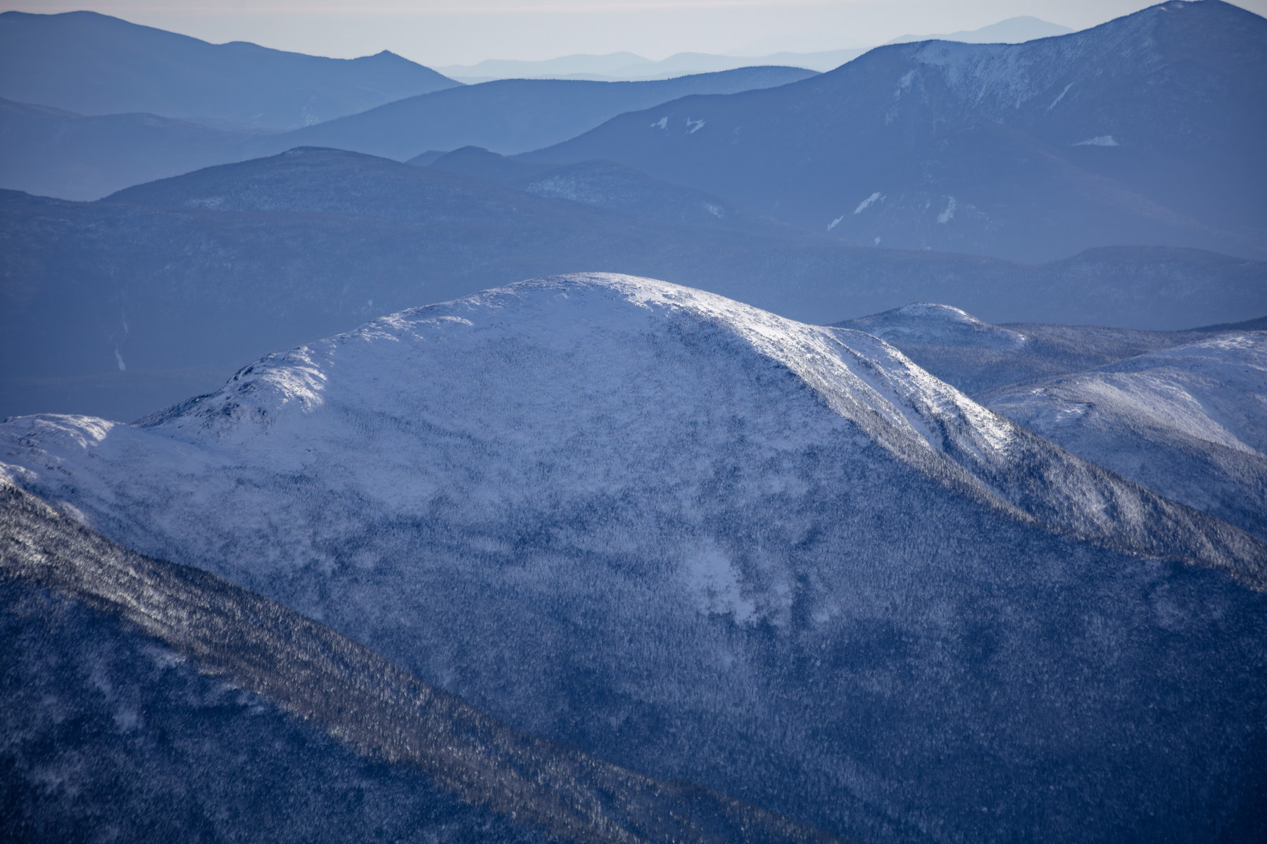 Winter Light on Mount Eisenhower Summit
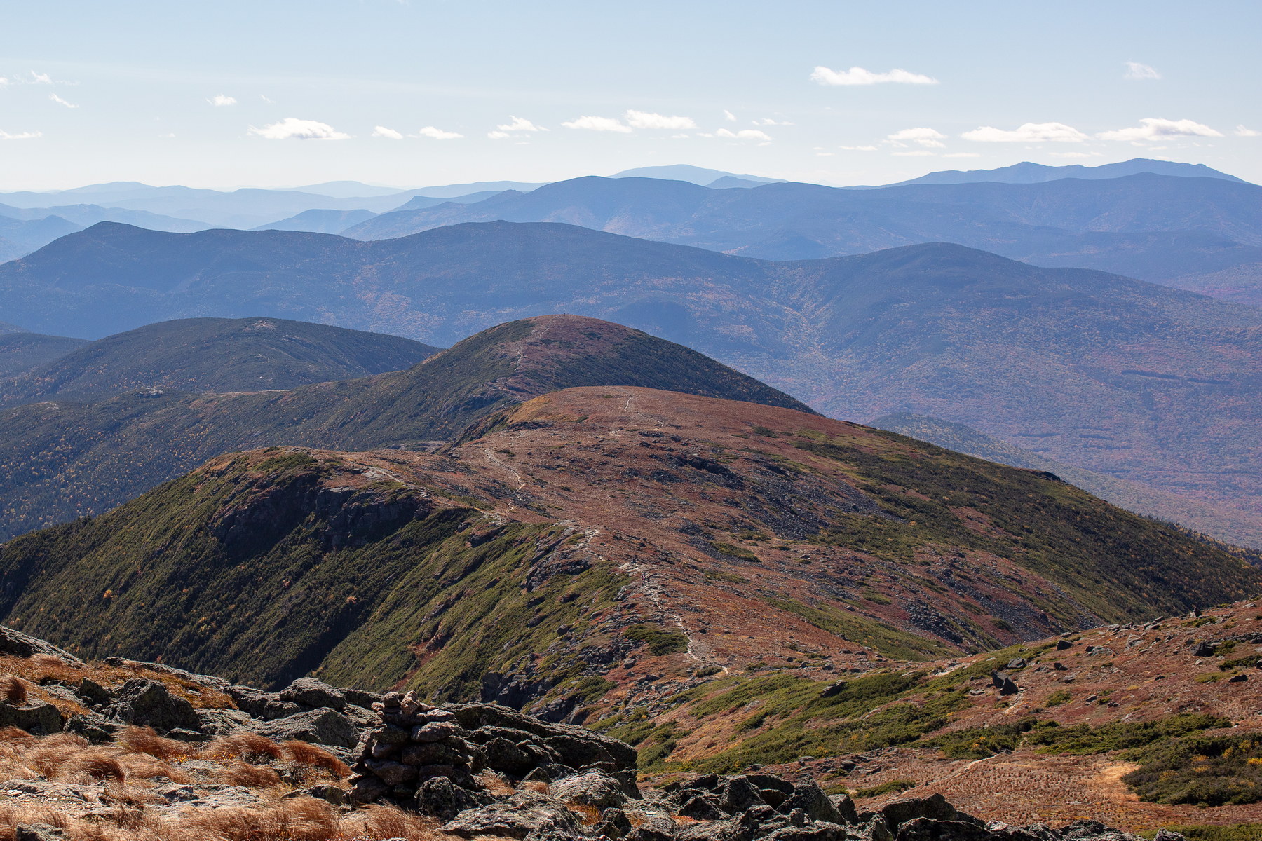 Rocky Ridge Trail on Mount Eisenhower
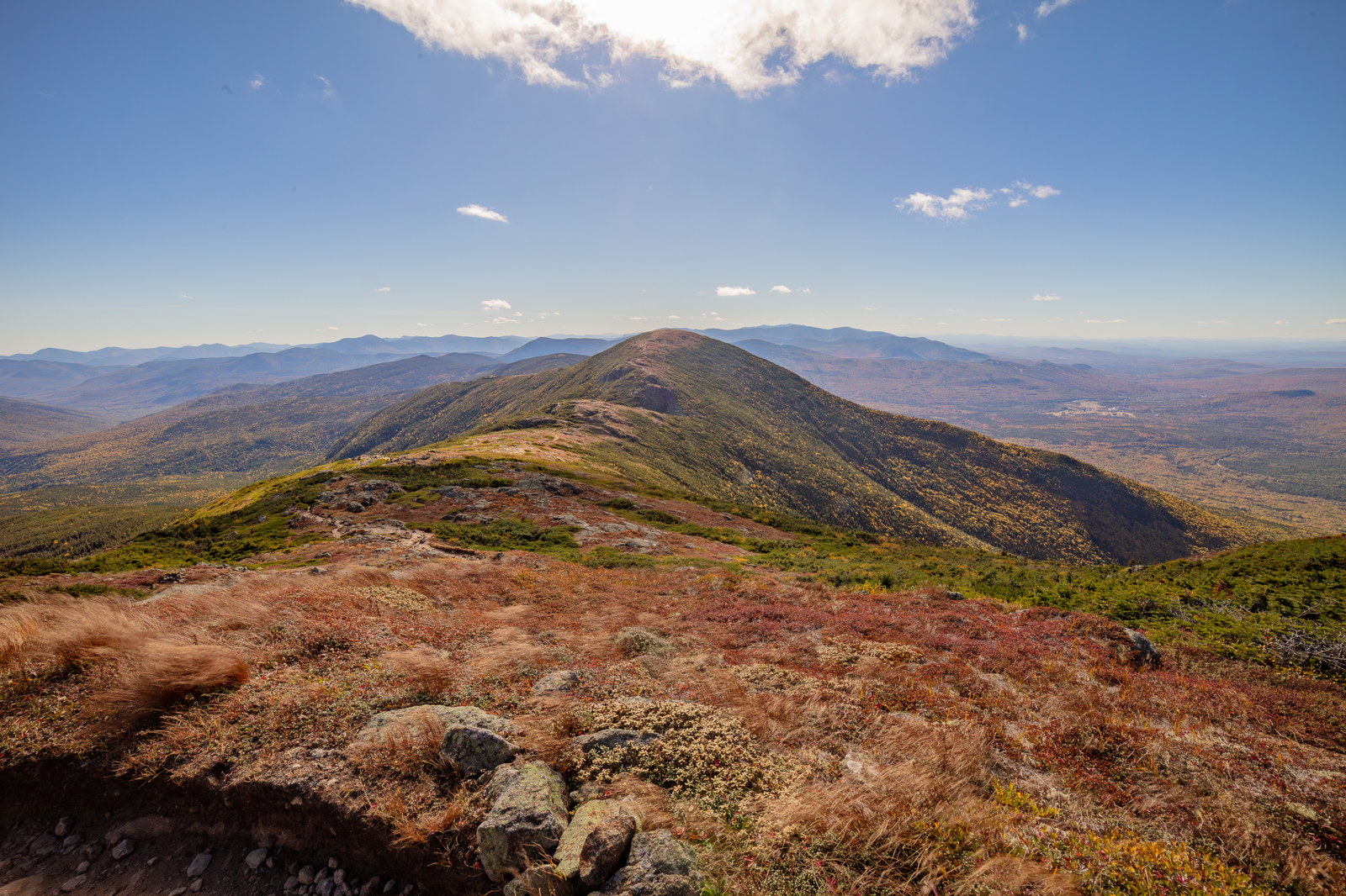
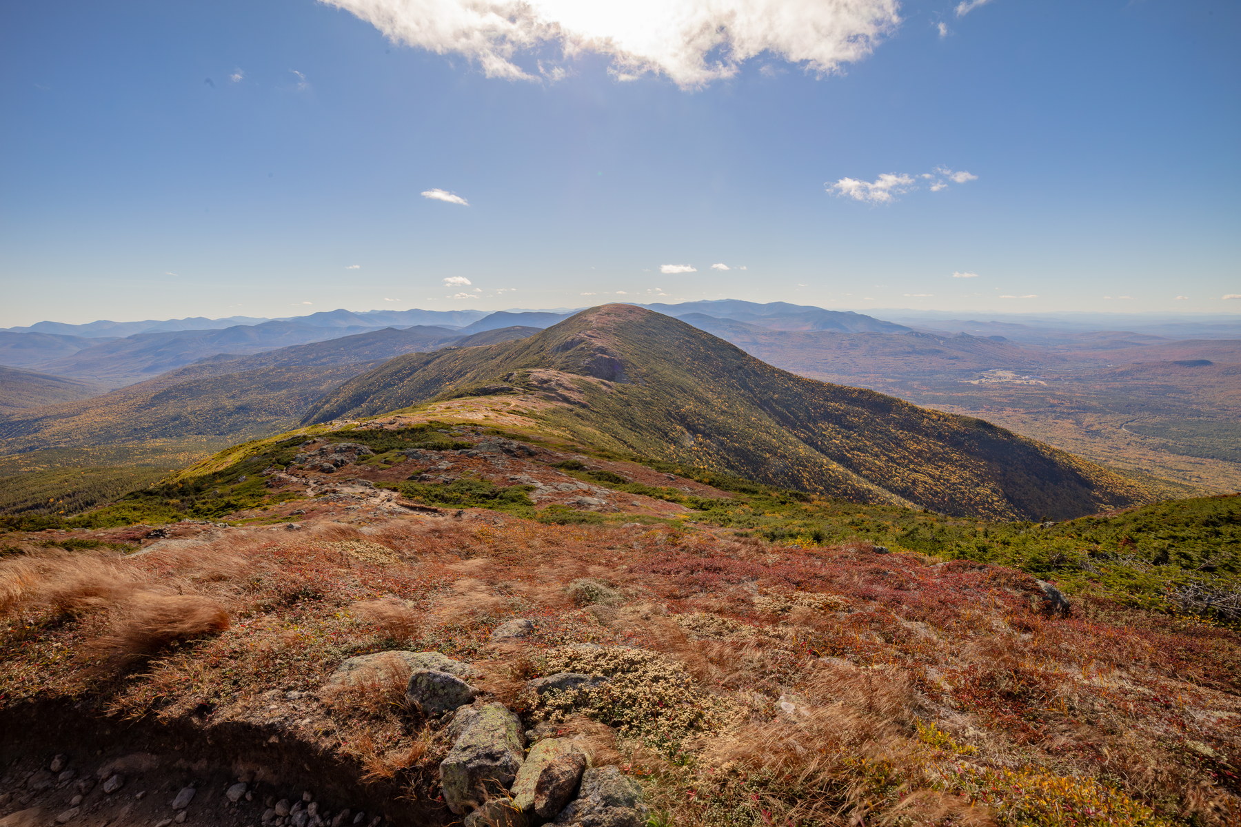 Vast Ridge Line of Mount Eisenhower in Fall
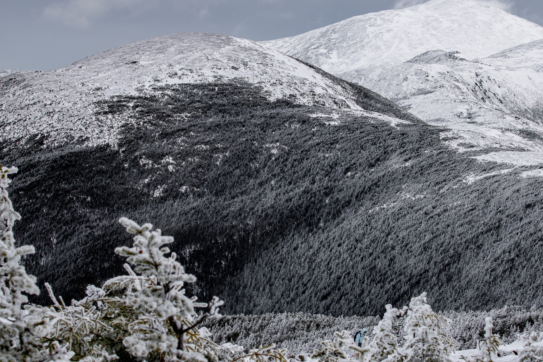 Frosted Pines Below Mount Eisenhower Ridge
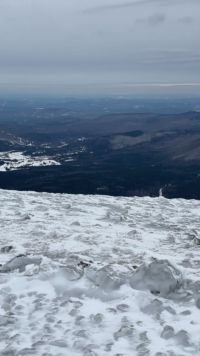 Ice-Swept Summit Slopes on Mount Eisenhower
Open video page
Ice-Swept Summit Slopes on Mount Eisenhower
Open video page
NH48 stylized terrain with summit marker, contours, and nearby trails.
Static map preview
Mount Eisenhower: summit area with linked trail context.
NOAA / NWS point forecast for this summit location.
Live summit weather is temporarily unavailable. Static trip-planning guidance remains available below.
Sun and moon timing for this peak.
Astronomy timing is temporarily unavailable.
Stream context
Maintained by NHDOT - NOT maintained for winter travel
Verify official sources and posted signs before driving to a trailhead.