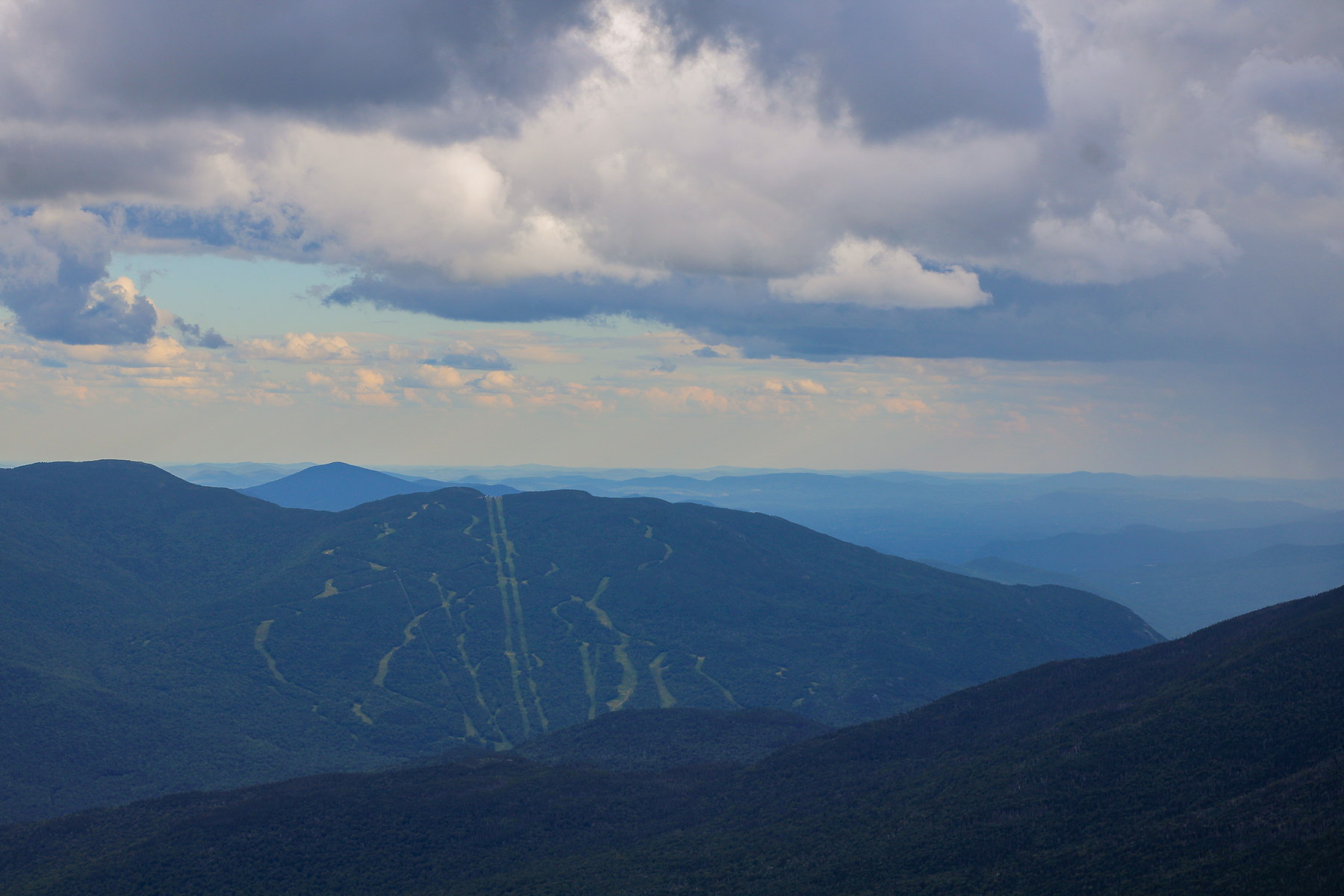
Wildcat Mountain “D” Peak is a 4,050-foot summit on Wildcat Mountain, located in Coös County, New Hampshire. It is at the northwest end of the Wildcat Ridge, directly above the Wildcat Mountain Ski Area in Pinkham Notch. Wildcat D is one of two summits of Wildcat Mountain recognized as 4,000-footers (the other being the higher “A” Peak). The summit of Wildcat D is the site of the top of a gondola lift and an observation deck, from which there are spectacular views across Pinkham Notch to Mount Washington and the Presidential Range. Wildcat D Peak is often the starting or ending point for hikers traversing the Wildcat Ridge Trail, which runs from Pinkham Notch over Wildcat’s peaks and on toward Carter Dome. Wildcat “D” Peak is one of two summits of Wildcat Mountain that qualify as 4,000-footers (the other being Wildcat A). Wildcat D is unique in that it sits at the top of the Wildcat Mountain Ski Area, directly across Pinkham Notch from Mount Washington. In January 1958, Wildcat Ski Area made history by opening the first gondola lift in the United States – a lift that carried skiers from the base up to Wildcat D’s summit ridge. This “Wildcat Gondola” was a European-built 2-person enclosed cabin lift (sometimes called the “Wildcat Valley Tramway”), and it was revolutionary for American skiing. The governor of NH christened it with a bottle of champagne on opening day. Wildcat thus became one of the premier ski resorts in the East. The original gondola operated until 1999 (with a few incidents, including a notable rollback accident in its first season 1958 which fortunately caused no fatalities but led to improved safety standards). It was replaced by a modern cable car and later by a high-speed chairlift, though even today in summer the ski area sometimes runs a few gondola cabins for scenic rides. At the summit of Wildcat D there is an observation deck (near the top of the lift) which has spectacular views across Pinkham Notch to Tuckerman Ravine and Mount Washington – this is one of the most photographed views in the White Mountains, and it has been a draw since the 19th century when tourists would climb or ride up Glen Ellis Falls trail to get a view from Wildcat’s ledges. The Wildcat range itself got its name from the catamounts that were once common in the area; while none remain, hikers in the early 1900s occasionally reported seeing tracks or hearing screams attributed to these elusive predators. Wildcat D’s summit area is partly cleared due to ski operations, but it’s within the White Mountain National Forest on a long-term lease. The Appalachian Trail was re-routed to pass over Wildcat D (and use the gondola area) when the AT was established in the 1930s. For thru-hikers, the sudden encounter with a ski summit station – complete with gondola, cafeteria (in season), and crowds of tourists – can be surreal after miles in wilderness. It’s a reminder of how the White Mountains have been a multi-use landscape. The third-generation tram (planned for the late 2020s) will continue Wildcat’s legacy as a ski innovator. Meanwhile, hikers still traverse Wildcat Ridge for the challenge and the views, experiencing both the wild aspect of “Wildcat” on the rugged trail and the modern recreation at Wildcat D. The juxtaposition is a fascinating part of the mountain’s story, bridging 19th-century lore and 20th-century development.