
NH48 Info
व्हाइट माउंटेन राष्ट्रीय वन के 48 चार‑हजार‑फुट शिखरों के लिए खुला डेटा, रास्ते और फोटो मेटाडेटा प्रदान करता है। कैटलॉग ब्राउज़ करें, व्हाइट माउंटेन ट्रेल्स का अन्वेषण करें, और इस डेटा सेट का उपयोग करके एप्लिकेशन बनाएं।
Main Menu
शिखर कैटलॉग
सभी 48 चार‑हजार‑फुट शिखरों के विवरण देखें, जिसमें ऊँचाई, प्रॉमिनेंस, कठिनाई और फोटो थंबनेल शामिल हैं।
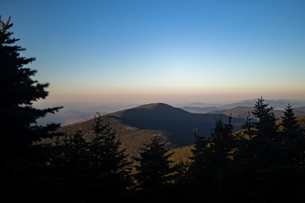
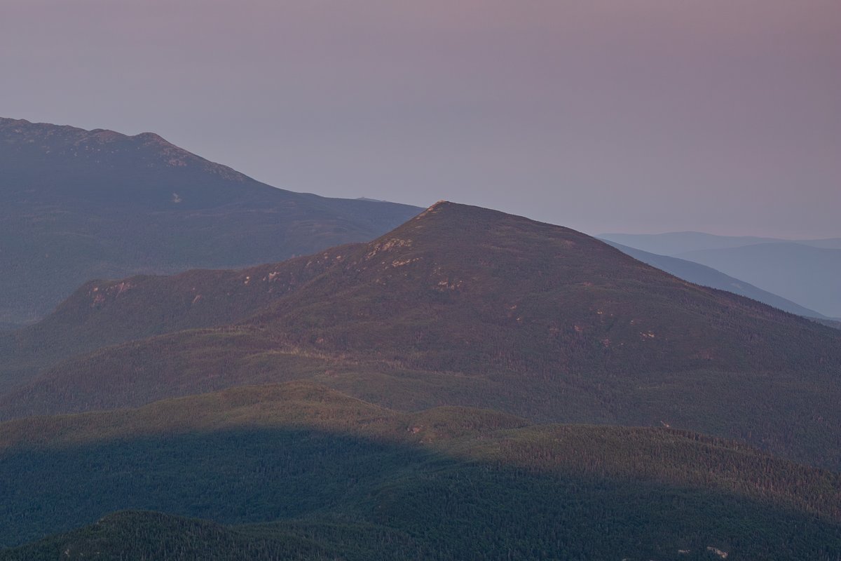
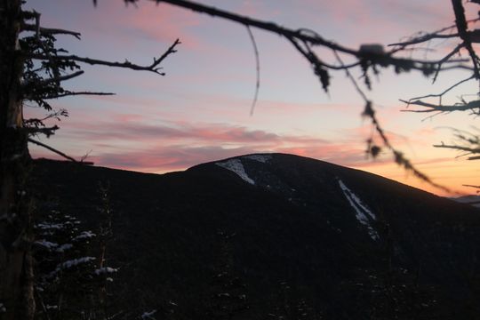 Title: Twilight Glow Over Carter Dome Headline: At Sunset with Snowy Patches and Silhouetted Trees in Winter Creator: NATHAN SOBOL Description: The rugged silhouette of Carter Dome in the White Mountains of New Hampshire is framed by frosted evergreens under a soft winter sunset sky. Patches of snow linger on granite ledges, highlighting the alpine zone as the forest trail below fades into dusk. Alt Text: Carter Dome peak at sunset with snowy patches and silhouetted trees in winter Extended Accessibility: Captured in the waning light of a January evening, this landscape photography showcases Carter Dome's distinctive rounded summit within the White Mountain National Forest. The scene reveals subtle snow cover on granite ledges and a quiet forest trail, emphasizing the serene beauty of New Hampshire's White Mountains during winter. The sky's pastel hues reflect the calm atmosphere as daylight fades behind the alpine zone. Keywords: carter-dome, winter, sunset, landscape, Carter Dome, White Mountains, New Hampshire, White Mountain National Forest, landscape photography, alpine zone, granite ledges, forest trail
ट्रेल एक्सप्लोरर
इंटरैक्टिव मानचित्र का उपयोग करके व्हाइट माउंटेन ट्रेल्स का अन्वेषण करें और खुला डेटा सेट डाउनलोड करें।
 Title: Sunlit Granite Slopes of Mount Lafayette Headline: Granite Slopes Illuminated by Sunset with Forest Foreground and Cloudy Sky Creator: NATHAN SOBOL Description: Afternoon sunlight highlights the rugged granite ledges of Mount Lafayette, casting warm tones over the alpine zone. The dense forest trail in the foreground contrasts with the rocky summit, set against a backdrop of dynamic summer clouds in New Hampshire’s White Mountains. Alt Text: Mount Lafayette granite slopes illuminated by sunset with forest foreground and cloudy sky Extended Accessibility: This landscape photography captures Mount Lafayette within the Franconia Range of the White Mountains, New Hampshire, during a summer sunset. The image emphasizes the textured granite ledges near the summit and the surrounding alpine zone, framed by a forest trail. The interplay of light and shadow under shifting clouds adds depth and drama to the scene inside the White Mountain National Forest. Keywords: mount-lafayette, summer, sunset, landscape, Mount Lafayette, White Mountains, New Hampshire, White Mountain National Forest, Franconia Range, landscape photography, granite ledges, alpine zone, forest trail
लंबे ट्रेल्स
एपलाचियन ट्रेल जैसे लंबे मार्गों के बारे में जानें।
पौधों का कैटलॉग
व्हाइट माउंटेन के अल्पाइन और महत्वपूर्ण पौधों की सूची ब्राउज़ करें।
Last Modified: 04/17/2026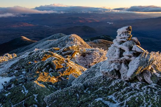
Howker Ridge Trail जानकारी
Howker Ridge Trail का इतिहास, ऊँचाई प्रोफाइल, खंड और रुचि स्थल जानें।
Last Modified: 03/29/2026 Title: Evening Shadows over Mount Carrigain Headline: Forested Ridges and Cloudy Summer Sky at Sunset Creator: NATHAN SOBOL Description: Mount Carrigain rises prominently in the White Mountains of New Hampshire, framed by deepening shadows and a textured sky as summer transitions into evening. The layered ridge lines of the White Mountain National Forest create a dramatic contrast under the soft, fading light. Alt Text: Mount Carrigain summit with forested ridges and cloudy summer sky at sunset Extended Accessibility: This landscape photograph captures Mount Carrigain in the White Mountains of New Hampshire during a summer sunset. The scene highlights the mountain's broad, forested slopes beneath a sky filled with scattered clouds, casting varied shadows across the ridge lines. The peaceful atmosphere evokes the quiet end of a hiking day in the White Mountain National Forest, showcasing the interplay of light and mountain weather typical of the region. Keywords: mount-carrigain, summer, sunset, landscape, Mount Carrigain, White Mountains, New Hampshire, White Mountain National Forest, ridge line, mountain weather, landscape photography
NH48 Planning & Info
Start with the NH 4,000-Footers guide, then launch the interactive planner to build and reorder your trip templates.
Last Modified: 04/08/2026 Title: Granite Textures of Mount Adams Ridge Headline: Rocky Ridge Line with Clouds and Forest Below Creator: NATHAN SOBOL Description: Mount Adams rises prominently in New Hampshire's White Mountains, its granite ledges illuminated by late afternoon light. The rugged alpine zone contrasts with patches of forest below, all within White Mountain National Forest's Presidential Range. Cloud shadows move across the mountain weather, highlighting the textured ridge line. Alt Text: Rocky ridge line of Mount Adams with clouds and forest below in White Mountains Extended Accessibility: This landscape captures Mount Adams in the White Mountain National Forest during a summer afternoon. The photo emphasizes the mountain’s granite ledges and alpine zone, with dynamic cloud cover casting shadows across the rugged terrain. The Presidential Range’s characteristic forest trails and rocky ridges are visible, illustrating the natural beauty and varied textures of this New Hampshire peak under shifting mountain weather. Keywords: mount-adams, summer, day, landscape, Mount Adams, White Mountains, New Hampshire, White Mountain National Forest, Presidential Range, granite ledges, alpine zone, ridge line, mountain weather
Photo Games
Play through three photo-first ways to learn the peaks: classic matching, timed rounds, or a slower jigsaw mode.
Last Modified: 03/23/2026
NH52WAV
Browse New Hampshire’s 52 With a View peaks through the companion catalog with scenic list coverage, route details, and live peak pages.
White Mountains Visual Wiki
Browse connected mountain, plant, and animal entries in a visual field-guide format built for hikers and researchers.
NH48 कैटलॉग
शिखर सूची
न्यू हैम्पशायर के 4,000 फीट से ऊँचे 48 शिखरों को सिर्फ एक चेकलिस्ट नहीं, बल्कि जीवंत पृष्ठों के रूप में देखें। पर्वत श्रृंखलाओं के अनुसार व्यवस्थित यह कैटलॉग ऊँचाई, प्रमुखता, मार्ग प्रकार, कठिनाई, एक्सपोज़र और शिखर फ़ोटोग्राफी को सामने लाता है, और फिर विस्तृत गाइड्स में खुलता है—मानचित्र, मौसम, पहुँच और वास्तविक अनुभवों के साथ। यहाँ से शुरुआत करें, जब आप पूरी सूची को समझने योग्य बनाना चाहते हों।
- लाइव पीक कार्ड्स और रेंज फ़िल्टर NH48 डेटा से संचालित।
- कार्ड्स ऊँचाई, प्रमुखता, मार्ग प्रकार और कठिनाई दिखाते हैं, फिर पूरा गाइड खोलते हैं।
- रेंज के अनुसार ब्राउज़िंग सीधे उन गाइड्स तक ले जाती है जहाँ मानचित्र, मौसम, पहुँच और फ़ोटो मिलते हैं।
खोज, रेंज फ़िल्टर और वास्तविक NH48 कार्ड्स इस पैनल के पास आने पर यहाँ लोड होंगे।
ट्रेल एक्सप्लोरर
ट्रेल एक्सप्लोरर
यहाँ ट्रेल खोज को सरल बनाया गया है। एक क्षेत्र चुनें और एक ही स्क्रीन पर मानचित्र, सूची, खोज, दूरी, ट्रेल प्रकार और रूट फ़िल्टर के साथ विकल्पों की तुलना करें। यह किसी जटिल टूल जैसा नहीं, बल्कि एक साफ़ नक्शे के सामने खड़े होकर सही रास्ता चुनने जैसा लगता है।
- मानचित्र, फ़िल्टर और सूची हमेशा सिंक में रहते हैं।
- NH48 डिफ़ॉल्ट शुरुआती क्षेत्र बना रहता है, लेकिन दूसरा ट्रेल डेटा भी तुरंत देखा जा सकता है।
- कॉम्पैक्ट मानचित्र स्थिति और चुने हुए रूट सीधे पूरे
/trailsअनुभव तक ले जाते हैं।
यह पैनल स्क्रॉल करते समय लाइव क्षेत्र सूची, चुने हुए ट्रेल और कॉम्पैक्ट रूट मानचित्र के साथ लोड होगा।
NH48 गाइड
NH48 गाइड
यह गाइड पूरी सूची को समझने योग्य बनाता है। इसमें NH48 का ढांचा, पर्वत समूह, दिनभर की हाइक योजनाएँ, शुरुआती विकल्प, कठिनाई स्तर, मौसम और जोखिम की जानकारी, और रणनीतियाँ शामिल हैं। इसे पढ़ने के बाद आप पूरे प्रोजेक्ट को अलग नज़र से देखेंगे।
- डेटा वही है जो प्लानर और पीक पेज में उपयोग होता है।
- यह प्रीव्यू सूची को समझने और ट्रिप बनाने की योजना को अलग रखता है, ताकि आप पहले संरचना समझ सकें।
- रेंज फ़िल्टर, तालिका पंक्तियाँ और समूह उसी जीवित गाइड संरचना को दर्शाते हैं।
रेंज फ़िल्टर और कॉम्पैक्ट गाइड पंक्तियाँ यहाँ लाइव गाइड और प्लानर डेटा से दिखाई देंगी।
लंबी ट्रेल्स
लंबी ट्रेल्स
यहाँ पैमाना बदल जाता है। Appalachian Trail, Pacific Crest Trail और अन्य लंबी ट्रेल्स को सेक्शन दर सेक्शन खोजा जा सकता है, इंटरैक्टिव मानचित्र और डाउनलोड योग्य डेटा के साथ। यह बड़े सफ़र की योजना बनाने का आसान तरीका है।
- सभी सेक्शन एक ही डेटा सिस्टम से जुड़े हैं।
- यह प्रीव्यू पूरे एक्सप्लोरर से पहले रूट पहचान, सेक्शन और भूगोल को स्पष्ट करता है।
- यह पैनल दिखाता है कि NH48 की डेटा संरचना लंबी दूरी के रूट्स तक भी साफ़ तरह से बढ़ती है।
कॉम्पैक्ट रूट कार्ड्स और एक छोटा Long Trails मानचित्र यहाँ सेक्शन डेटा से लोड होगा।
Howker Ridge की वनस्पति
Howker Ridge की वनस्पति
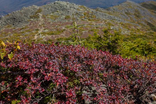
हर पर्वत कहानी सिर्फ शिखरों से नहीं बनती। यह कैटलॉग Howker Ridge की वनस्पति को दर्शाता है—अल्पाइन पौधे, दलदली क्षेत्र, झाड़ियाँ और लाइकेन—जो मौसम, आवास और प्रकार के अनुसार व्यवस्थित हैं।
- फ़िल्टर आपको इसे एक फील्ड गाइड की तरह एक्सप्लोर करने देते हैं।
- प्रजाति कार्ड्स जीवित Howker पौधा कैटलॉग से आते हैं, जिनमें वास्तविक चित्र, नोट्स और आवास संकेत शामिल हैं।
- प्रीव्यू पारिस्थितिक विवरण को घटाए बिना कैटलॉग और पौधा मानचित्र तक ले जाता है।
Howker पौधा कैटलॉग का जीवित हिस्सा यहाँ वास्तविक प्रजाति कार्ड्स और प्रकार फ़िल्टर के साथ लोड होगा।
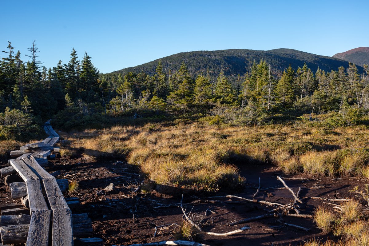
Howker Ridge ट्रेल जानकारी
Howker Ridge ट्रेल जानकारी
यह पेज Howker Ridge को एक कहानी की तरह प्रस्तुत करता है। Bumpus Brook से लेकर Mount Madison तक की यात्रा में भू-भाग, दृश्य, पारिस्थितिकी और महत्वपूर्ण निर्णयों को विस्तार से बताया गया है।
- वास्तविक पॉइंट्स, डेटा और मानचित्र से जुड़ा हुआ।
- रुचि के बिंदु, मुख्य आकर्षण और रूट संदर्भ उसी डेटा से आते हैं जो गंतव्य पन्नों पर उपयोग होता है।
- यह पैनल कथात्मक गाइड और इंटरैक्टिव मानचित्र की झलक देता है, बिना पूरे प्रोजेक्ट को यहाँ ठूँसने की कोशिश किए।
रूट मेट्रिक्स, पॉइंट ऑफ इंटरेस्ट बटन और छोटा मानचित्र यहाँ लाइव Howker Ridge डेटा से लोड होंगे।
NH48 योजना
NH48 योजना
यहाँ योजना बनाना सिर्फ सूची को क्रमबद्ध करना नहीं है। यह टूल आपको हाइक को समूहों में बाँटने, यात्रा योजनाएँ बनाने और अपनी प्रगति को व्यवस्थित करने में मदद करता है।
- अपने ट्रिप्स को बनाएं, एडजस्ट करें और एक्सपोर्ट करें।
- होमपेज प्रीव्यू हल्का रहता है, लेकिन वही योजना संरचना और दिनभर की समूह रणनीतियाँ दिखाता है जो पूरे प्लानर में हैं।
- गाइड नोट्स और योजना क्रियाएँ एक ही संदर्भ में जुड़ी रहती हैं, ताकि रणनीति से यात्रा तक पहुँचना आसान हो।
रणनीति फ़िल्टर और खींचकर व्यवस्थित किए जा सकने वाले यात्रा समूह यहाँ NH48 प्लानर डेटा से लोड होंगे।
फ़ोटो गेम्स
फ़ोटो गेम्स
यहाँ फ़ोटो सिर्फ देखने के लिए नहीं हैं—वे सीखने का माध्यम बनती हैं। पहाड़ों की पहचान करें, समय के खिलाफ खेलें, या पज़ल के रूप में उन्हें फिर से बनाएं।
- याददाश्त, गति और विज़ुअल पहचान—तीनों एक साथ।
- हर मोड NH48 आर्काइव की वास्तविक शिखर फ़ोटोग्राफी का उपयोग करता है, न कि किसी सामान्य गेम कला का।
- होमपेज प्रीव्यू PeakID, timed mode और puzzle अनुभव की झलक देता है, फिर आपको पूरे गेम तक ले जाता है।
हर फ़ोटो गेम मोड की एक कॉम्पैक्ट खेलने योग्य झलक यहाँ वास्तविक पर्वत फ़ोटो के साथ लोड होगी।
NH52WAV
NH52WAV
यह सूची NH48 से आगे बढ़ती है और नए शिखरों की दुनिया खोलती है। हर शिखर के लिए वही गहराई और जानकारी मिलती है—रूट, मानचित्र, मौसम और फ़ोटोग्राफी के साथ।
- NH48 जैसा ही अनुभव, एक विस्तारित सूची में।
- होमपेज प्रीव्यू वास्तविक NH52WAV कैटलॉग रेंडरर, खोज प्रवाह और रेंज स्लाइस का उपयोग करता है।
- सीधे शिखर लिंक पूर्ण गाइड पन्नों तक ले जाते हैं जहाँ मानचित्र, योजना नोट्स और पर्वत फ़ोटोग्राफी मिलती है।
खोजे जा सकने वाले NH52WAV कार्ड्स यहाँ उसी रेंडरर और पर्वत डेटा से लोड होंगे जो पूरे कैटलॉग में उपयोग होता है।
व्हाइट माउंटेन्स विज़ुअल विकी
व्हाइट माउंटेन्स विज़ुअल विकी
यह सिर्फ एक सूची नहीं, बल्कि ज्ञान का नेटवर्क है। इसमें पर्वत, पौधे, जानवर और जंगल की स्थिति एक साथ जुड़े हुए हैं, जिससे आप प्रकृति को गहराई से समझ सकते हैं।
- पर्वत से पारिस्थितिकी तक एक जुड़ा हुआ अनुभव।
- यह पैनल उन्हीं विकी डेटा स्रोतों से लाइव श्रेणी गिनती और एंट्री लिंक दिखाता है जो अंतिम पन्नों पर उपयोग होते हैं।
- आप पर्वत, पौधे, जानवर और वन स्वास्थ्य के बीच जाते हुए भी पूरे विज़ुअल गाइड का संदर्भ बनाए रख सकते हैं।
लाइव एंट्री गिनती, श्रेणी टॉगल और जुड़े विकी लिंक यहाँ वर्तमान पर्वत, पौधा, पशु और वन-स्वास्थ्य डेटा से लोड होंगे।
सीधे NH48 साइट से निर्मित
ये पैनल आपके वास्तविक पर्वत, ट्रेल, गाइड, योजना, पौधा, गेम और विकी डेटा का उपयोग करते हैं, ताकि होमपेज साइट का एक गहरा और स्क्रॉल किया जा सकने वाला प्रीव्यू बने, न कि केंद्र कार्ड ग्रिड के नीचे रखा गया कोई सामान्य SEO ब्लॉक।
NH48 is a guide-first hub for New Hampshire 4,000-footers and the wider White Mountains, with peak pages, trail tools, range catalogs, photos, and authenticated API access for cloud fetches.
About NH48, the guides, and the data
About NH48, the guides, and the data
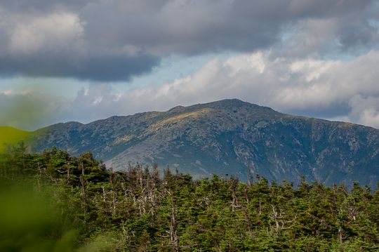
 Title: Twilight Over Mount Adams Granite Ledges Headline: Granite Rocks Beneath Evening Clouds Creator: NATHAN SOBOL Description: Mount Adams rises prominently within the White Mountains of New Hampshire as evening light filters through scattered clouds. The rugged granite ledges and alpine zone vegetation highlight the mountain's wild character in the White Mountain National Forest's Presidential Range. Alt Text: Mount Adams summit ridge with granite rocks and evening clouds in White Mountains Extended Accessibility: This late summer sunset scene captures Mount Adams in the White Mountains, New Hampshire, showcasing its granite ledges and alpine zone flora. The dynamic sky with patches of sunlight and shadow creates a dramatic atmosphere over the Presidential Range within the White Mountain National Forest. The rugged terrain and distant forest trails emphasize the mountain's natural beauty and appeal to hikers and outdoor enthusiasts. Keywords: mount-adams, summer, sunset, landscape, Mount Adams, White Mountains, New Hampshire, White Mountain National Forest, Presidential Range, granite ledges, alpine zone, hiking
Forested ridgelines and alpine terrain in the Presidential Range.
(c) Nathan Sobol; Canon EOS 5DS R; 1 sec, ISO 100; captured Aug 28, 2025. Home -> Peak Catalog -> Mount Adams
NH48.info is a volunteer‑run White Mountains reference centered on New Hampshire’s 48 four‑thousand‑foot peaks. The site now combines detailed peak guide pages, route and trail context, range-level browsing, photo-rich summit coverage, and a growing visual wiki for hikers, planners, researchers, and curious mountain people.
Most of the site is meant to be read like a normal guide first. You can open a peak page for elevation, prominence, routes, nearby links, photos, and map context, then branch into the trail explorer, range catalog, or wiki when you want a wider view. For builders and data users, authenticated API access is available for NH48 and NH52WAV when you need cloud fetches and managed keys.
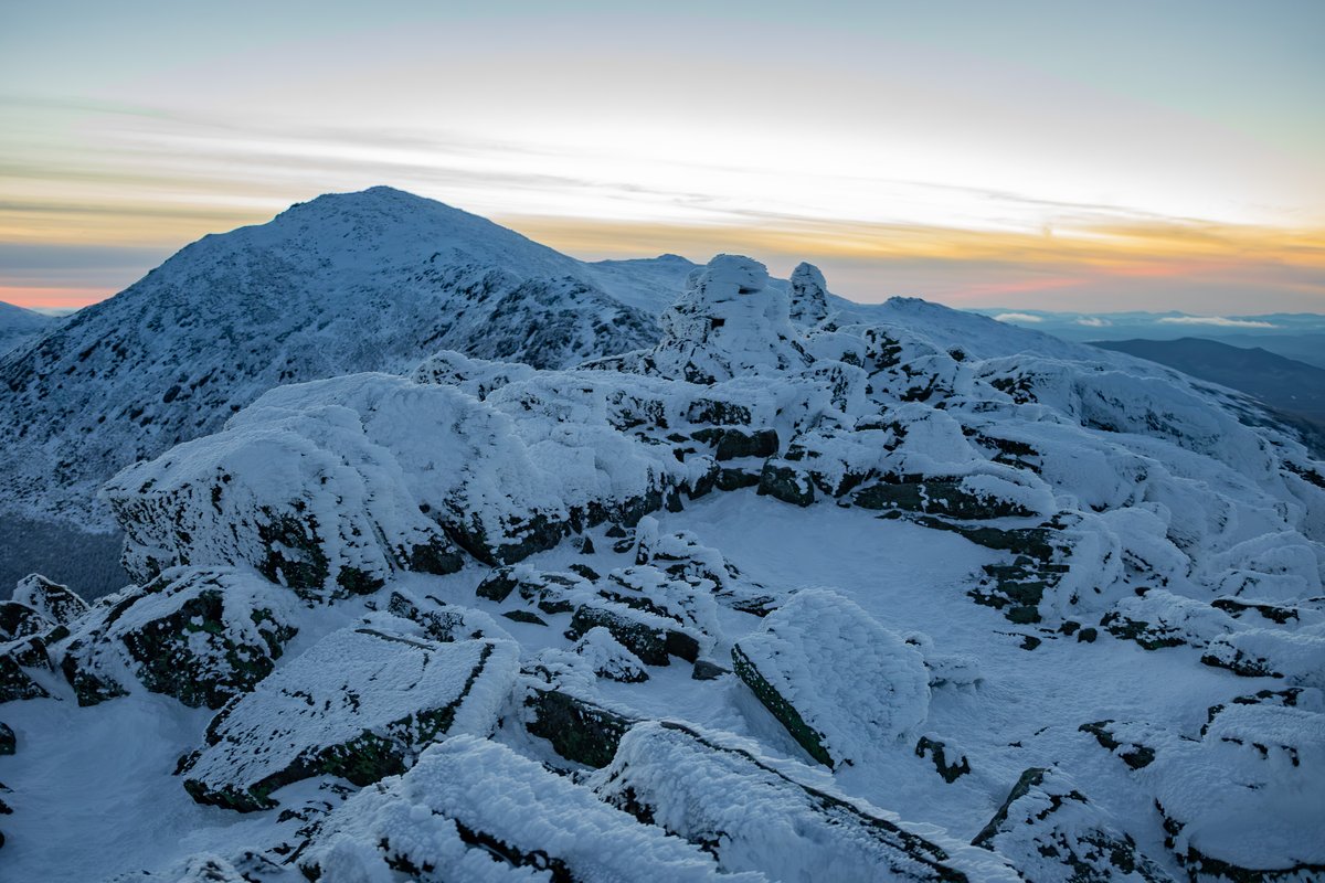
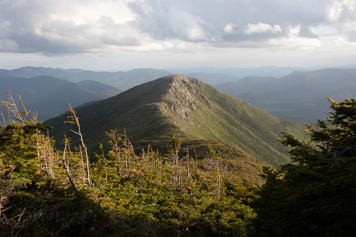
Send Edit to Author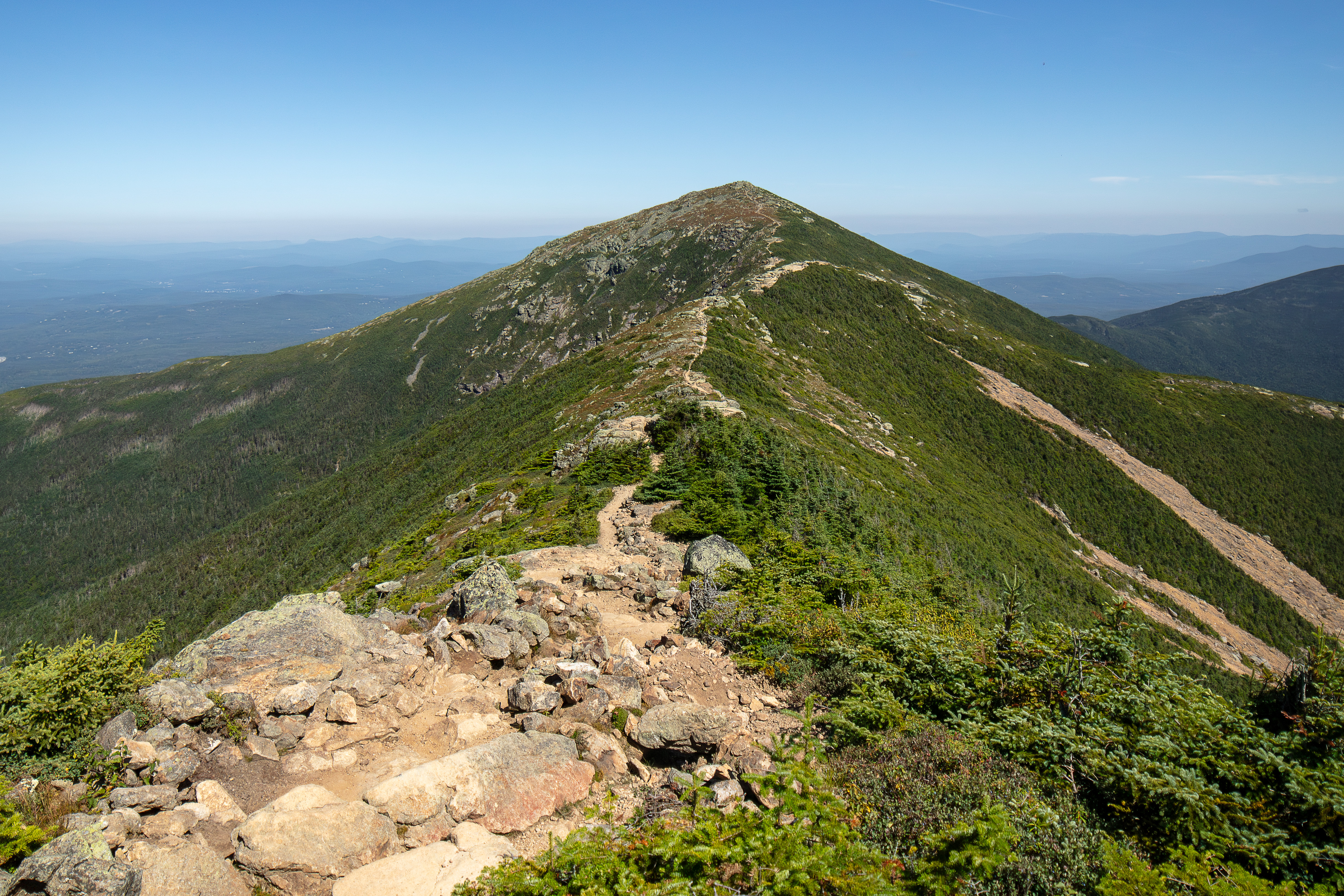 Title: Rocky Summit Trail on Mount Lafayette Headline: Rocky Hiking Trail Leading to Summit under Clear Blue Sky Creator: NATHAN SOBOL Description: A clear summer morning reveals the rugged trail winding up Mount Lafayette, part of New Hampshire's White Mountains. The Franconia Range's alpine zone and granite ledges are bathed in bright sunlight, highlighting the pristine forest trail and expansive views across the White Mountain National Forest. Alt Text: Rocky hiking trail leading to Mount Lafayette summit under clear blue sky in White Mountains Extended Accessibility: This landscape captures the rocky ascent along the ridge line of Mount Lafayette within the Franconia Range. The summer morning light accentuates the granite ledges and alpine vegetation typical of the White Mountain National Forest. The trail cuts through dense green forest and opens to panoramic vistas of New Hampshire's mountainous terrain, showcasing mountain weather conditions ideal for hiking and exploration. Keywords: mount-lafayette, summer, day, landscape, Mount Lafayette, White Mountains, New Hampshire, White Mountain National Forest, Franconia Range, alpine zone, granite ledges, forest trail, ridge line, mountain weather, hiking
Franconia Ridge terrain overlooking the White Mountains.
(c) Nathan Sobol; Canon EOS 5DS R; 1 sec, ISO 100; captured Aug 15, 2025. Home -> Peak Catalog -> Mount Lafayette
NH48 Peak Catalog – Browse all 48 peaks through dedicated guide pages with summit stats, route panels, range grouping, curated photos, and links into related trails and nearby peaks.
White Mountains Visual Wiki – Browse connected mountain, plant, and animal entries in a field-guide layout with internal links between peaks, trails, and natural history.
Range Catalog – Compare the Presidential, Franconia, Carter-Moriah, Kinsman, Twins and Bonds, and other groups in one place when you want a broader view than a single summit page.
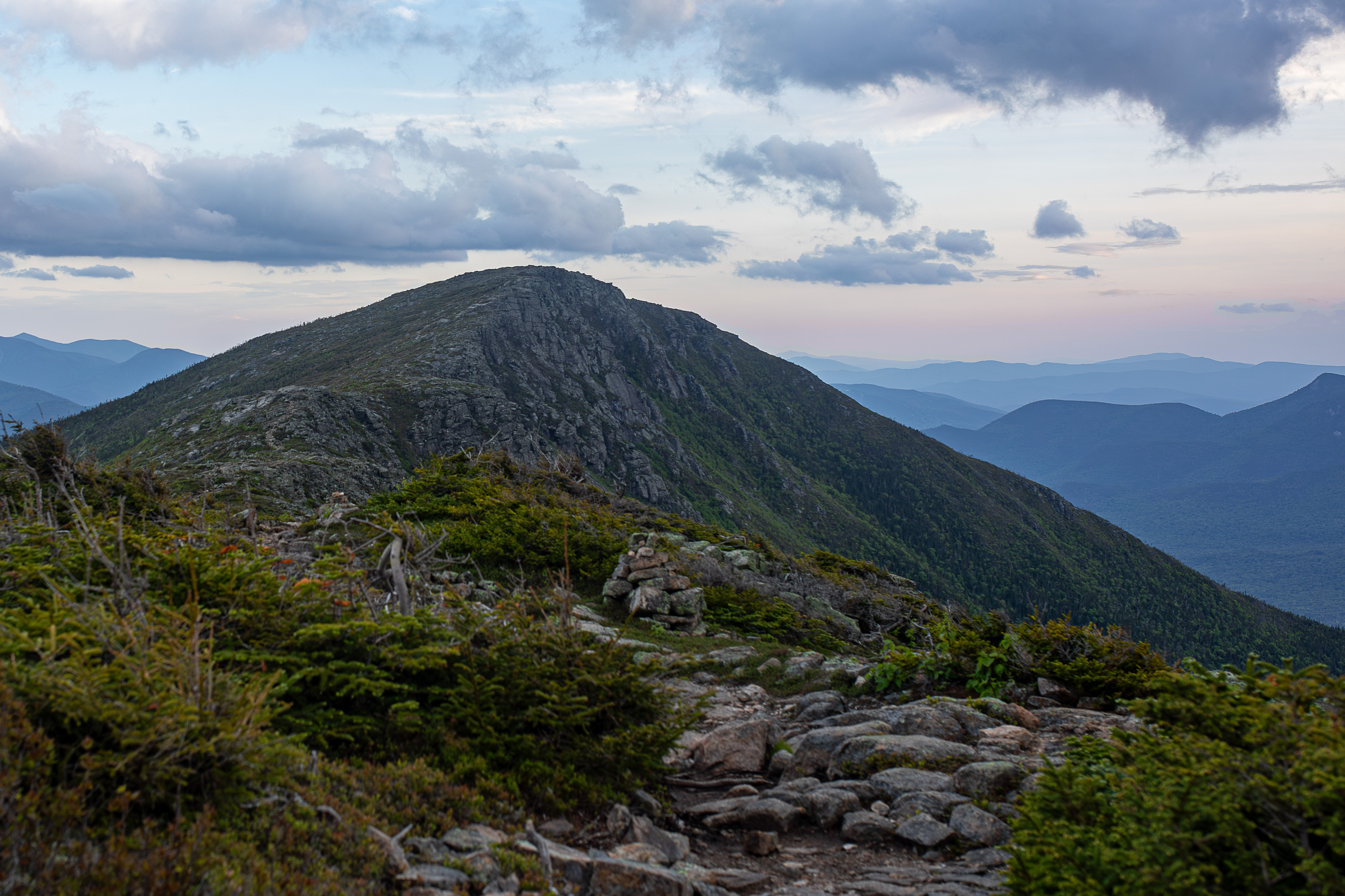 Title: Twilight Haze Over Bondcliff Summit Headline: Summit at Dusk with Rocky Trail and Distant Mountain Ridges Creator: NATHAN SOBOL Description: A serene view of Bondcliff in the White Mountains, New Hampshire, captured during summer twilight. The rugged granite ledges and alpine zone are softened by fading light, with the Pemigewasset Wilderness stretching into distant ridgelines under a partly cloudy sky. Alt Text: Bondcliff summit at dusk with rocky trail and distant mountain ridges in White Mountain National Forest Extended Accessibility: This landscape photograph showcases Bondcliff's rugged summit under a tranquil summer sunset in the White Mountain National Forest. The scene highlights the granite ledges and sparse alpine vegetation along the forest trail, with layers of blue mountain ridges fading into the horizon. The gentle cloud cover adds depth and mood to the Pemigewasset Wilderness setting, emphasizing the peaceful end of a summer day in New Hampshire's White Mountains. Keywords: bondcliff, summer, sunset, landscape, White Mountains, New Hampshire, White Mountain National Forest, Pemigewasset Wilderness, landscape photography, granite ledges, ridge line, alpine zone, forest trail
Pemigewasset Wilderness ridges with layered summit views.
(c) Nathan Sobol; Canon EOS 5D Mark IV; 35mm F1.4 DG HSM | Art 012, 1/125 sec, ISO 125; captured Jun 15, 2023. Home -> Peak Catalog -> Bondcliff
White Mountain Trails Explorer – Search and map official and unofficial trails across the White Mountain National Forest with segment-level distance, elevation gain, permitted uses, surface notes, and trailhead context.
Long Trails – Explore larger route systems such as the Appalachian Trail and Pacific Crest Trail with segment data, elevation profiles, and map geometry.
NH48 Photos – Browse mountain and trail photography with alt text, captions, and metadata that make the image archive useful for both people and machines.
API Access – Sign in with the shared NH48.app account system to review plan limits, manage keys, and fetch NH48 or NH52WAV from authenticated cloud endpoints.
Peak Planning Tool – Build day hikes and completion plans with route metrics, exposure context, and practical planning filters.
PeakID, Timed PeakID, and the Jigsaw Puzzle turn the photo archive into lighter-weight learning tools when you want a break from maps and stats.
Howker Ridge Plant Catalog – Document alpine and subalpine species along the Howker Ridge Trail with common and Latin names, habitat notes, bloom windows, elevation bands, and photo references.
Howker Ridge Trail Info – Read route history, elevation profiles, segments, and points of interest, then jump into the interactive map or the plant log map.
Because the site is maintained in spare time, conditions, closures, and land-management details can change. Please confirm current access and route status with official sources, and use the Send Edit to Author link if you spot something outdated or missing.
Photo use: Images are offered for non-commercial and educational use only; they remain the property of the site and may not be sold or printed without permission. For curated galleries and prints see NH48pics.com, and for peak-bagging progress and account tools see NH48.app.